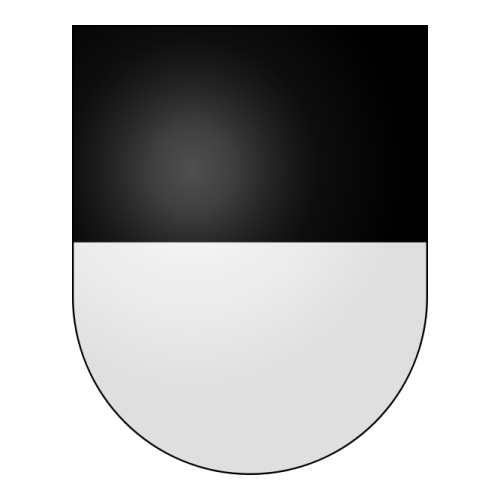
Administrasjon Cerniat
| Kode Cerniat (OFS) | 2126 |
|---|---|
| Postnummer Cerniat | 1654 |
| Ordfører Cerniat | Henri Buchs |
Kontaktinformasjon Cerniat
| Adresse Cerniat | 1654 CERNIAT Suisse |
|---|---|
| Telefon Cerniat | 090 112 60 16 (2chf + 2chf/mn) |
| E-post Cerniat | [email protected] |
| Nettsted Cerniat | www.cerniat.ch |
| Annen informasjon | Gemeinde Commune Comune : Cerniat |
| Fødselsattest Cerniat, Dødsattest Cerniat | |
Demografi Cerniat
| Antall innbyggere Cerniat | 339 Innbyggere |
|---|---|
| Befolkningstetthet Cerniat | 10,1 /km² |
Geografi Cerniat
| Geografiske koordinater Cerniat | Breddegrad: 46.667, Lengdegrader: 7.20277 46° 40′ 1″ Nord, 7° 12′ 10″ Øst |
|---|---|
| Overflate Cerniat | 3.369 Hektari 33,69 km² |
| Høyde Cerniat | 920 m |
| Klima Cerniat | Maritimt klima (Klimaklassifisering av Köppen: Cfb) |
Avstand Cerniat
| Zürich 129 km² | Genève 96 km² | Basel 104 km² |
| Lausanne 46 km² | Bern 35 km² | Winterthur 148 km² |
| Luzern 95 km² | St. Gallen 166 km² | Lugano 155 km² |
| Biel/Bienne 54 km² | Thun 33 km² Den nærmeste | Bellinzona 149 km² |
Kart og plan Cerniat
Byer og steder i nærheten Cerniat
| La Roche 4.3 km² | Hauteville 5.2 km² | Plasselb 6 km² |
| Corbières 6.4 km² | Crésuz 6.7 km² | Châtel-sur-Montsalvens 7.8 km² |
| Treyvaux 7.9 km² | Pont-la-Ville 8 km² | Jaun 8.3 km² |
| Botterens 8.5 km² | St. Silvester 8.5 km² | Plaffeien 9 km² |
Tid Cerniat
| Lokal tid Cerniat | |
|---|---|
| Tids-sone Cerniat | UTC +1:00 (Europe/Zurich) Sommertid UTC +2:00 Vintertid UTC +1:00 |
Vær Cerniat
Soloppgang og solnedgang Cerniat
| Dag | Soloppgang og solnedgang | Skumring | Astronomisk skumring | Nautisk skumring |
|---|---|---|---|---|
| 8 Juli | 05:46 - 13:36 - 21:25 | 05:08 - 22:04 | 04:16 - 22:55 | 03:06 - 00:06 |
| 9 Juli | 05:47 - 13:36 - 21:25 | 05:09 - 22:03 | 04:17 - 22:55 | 03:08 - 00:04 |
| 10 Juli | 05:48 - 13:36 - 21:24 | 05:10 - 22:03 | 04:19 - 22:54 | 03:10 - 00:03 |
| 11 Juli | 05:49 - 13:36 - 21:24 | 05:11 - 22:02 | 04:20 - 22:53 | 03:12 - 00:01 |
| 12 Juli | 05:50 - 13:36 - 21:23 | 05:12 - 22:01 | 04:21 - 22:52 | 03:14 - 23:59 |
| 13 Juli | 05:51 - 13:37 - 21:22 | 05:13 - 22:00 | 04:23 - 22:51 | 03:16 - 23:57 |
| 14 Juli | 05:52 - 13:37 - 21:22 | 05:14 - 21:59 | 04:24 - 22:49 | 03:18 - 23:55 |
Hotell Cerniat
 | Hotel Bad Schwarzsee Bad-Schwarzsee Offering panoramic views of Lake Schwarzsee and the Fribourg Alps, this 3-star hotel is just 150 metres from the lakeshore and 1 km from the Kaiseregg Ski Area. Free Wi-Fi is available. A tennis court and a miniature golf course are 100 metres away... Vis mer | Fra CHF 85 |
 | Centre Réformé Charmey In a quiet and green location, the Centre Réformé is 400 metres from the Gruyère Thermal Baths and 750 metres from the centre of Charmey. It features a sauna and a café serving Swiss specialities and snacks... Vis mer | Fra CHF 90 |
 | Hôtel Cailler Charmey Directly linked via an underground hallway to the Gruyère Spa, Hotel Cailler offers you charming country-style rooms and fine cuisine. The Gruyère spa includes a Turkish bath and sauna area, great pools and numerous other wellness facilities... Vis mer | Fra CHF 340 |
 | Hotel Le Sapin Charmey This hotel is set in the centre of the mountain village Charmey. The cable car and the Gruyère thermal baths are 100 metres away. Free public Wi-Fi is available... Vis mer | Fra CHF 130 |
 | Hotel de l'Etoile Charmey Located in the centre of the small village of Charmey in the Gruyère region, Hotel de l’Etoile occupies a restored 17th-century building. Free Wi-Fi and free private parking are available... Vis mer | Fra CHF 110 |
| Se andre hotell » | ||
I nærheten Cerniat
| Kloster Valsainte 1.9 km² | La Valsainte 1.9 km² | Valsainte 1.9 km² |
| La Berra 2.3 km² | Dent de Ruth 11.4 km² | Jaunpass 13.7 km² |
| Vanil Noir 15.4 km² | Le Gibloux 15.6 km² | Mont Gibloux 15.6 km² |
| Pfeife 15.6 km² | Selibühl 19.1 km² | Gantrisch 19.2 km² |
| Le Moléson 19.3 km² | Moléson 19.3 km² | Ober Simmental 19.9 km² |
| Ober Simmenthal 19.9 km² | Spillgerten 23.1 km² | Diemtigtal 23.4 km² |
| Diemtig Thal 23.4 km² | Pays d’ Enhaut 24.1 km² | Gummfluh 24.2 km² |
| Längenberg 24.7 km² | Stockhorn 25.3 km² | Giffershorn 25.7 km² |
| Gifferhorn 25.7 km² | Höhi Wispili 27.1 km² | Hohe Windspillen 27.1 km² |
| Wispile 27.1 km² | Männlifluh 29.6 km² | Albristhorn 29.6 km² |
Kjernekraftverk
| Mühleberg kjernekraftverk 34.2 km² | Gösgen kjernekraftverk 97.1 km² | Beznau kjernekraftverk 125.5 km² |
Side Cerniat
| Direkte link | |
|---|---|
| DB-City.com | Cerniat /5 (2020-06-09 08:24:25) |


